


Srinagar: Significant snowfall and rainfall occurred in Jammu and Kashmir (J&K) during the last 24 hours. Air and surface transport remained disrupted throughout the day on Friday and the Border Roads Organisation (BRO) said on Saturday morning that its men and machinery were working to remove the accumulated snow and ice to make the Srinagar International Airport operational today.
No flight operation could take place from the airport yesterday as the Srinagar-Jammu Highway also remained closed.
Traffic was also suspended on the Srinagar-Leh Highway and the Mughal Road yesterday and till now there is no official word on resuming traffic on these highways.
Due to the gusty winds that went ahead of the rain and snowfall in J&K, most of the electricity supply network was disrupted, but the ground staff and engineers of the electricity corporation worked overnight to restore more than 60 per cent of the supply till Friday evening.
The MET department said on Friday that the Western Disturbance (WD) that caused the precipitation has now moved out of J&K.
During the last 24 hours in the Jammu division, Batote recorded 116.8 mm rainfall, Ramban 50, Udhampur 68.8, Bhaderwah 75.4 mm and Banihal 22mm.
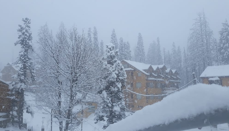
In the Valley, significant snow depth was recorded as Gulmarg at 50.8 cms, Kokernag 47, Pahalgam 46 and Qazigund 10 cms.
Minimum temperature was minus 1.4 degree Celsius in Srinagar, minus 12 in Gulmarg and minus 7.6 in Pahalgam on Saturday.
Jammu city had 4.5, Katra town 2, Batote minus 3.8, Banihal minus 4.4 and Bhaderwah minus 3.8 as the minimum temperature today.
MET department has forecast further drop in minimum temperature during the coming days due to frosty winds blowing into the Valley from the snowclad mountains.
Yesterday’s snowfall has come as a welcome event for people in J&K as it not only broke the continued dry spell, but also ensured accumulation of enough snow in the perennial water reservoir in higher reaches to sustain various water bodies during the hot summer months.
The MET department has forecast another WD becoming active over J&K from January 26 afternoon till January 28. This is likely to bring in more rain and snow in J&K.
A WD is an extra tropical storm in the Mediterranean region that brings in rain and snow in India, Pakistan, Nepal and Bangladesh. The prospects of a good Rabi crop depend upon the activity of the WDs in these countries.
(IANS)


