





Bhubaneswar: The India Meteorological Department (IMD) has attributed the ongoing heavy rainfall and severe flooding across Odisha to the unusually slow movement of a low-pressure system that formed over the Bay of Bengal.
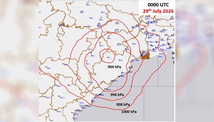
According to the IMD, a low-pressure area developed over the Northwest Bay of Bengal on July 25, which intensified into a depression and deep depression the next day on July 26. However, the system has moved at an exceptionally slow pace. Even after four days, it remains near Jharsuguda, having travelled less than 500 kilometres since its formation. This sluggish movement has resulted in prolonged heavy to very heavy rainfall over the state, triggering flood situations in multiple districts, particularly in northern and central Odisha.
Taking to his X handle, weather scientist wrote: “Very slow movement of the system…#LowPressure on 25th over Northwest Bay of Bengal, #Depression on 26th over same area…..Still after 4days system near Jharsuguda..travel less than 500km ….This has bring huge amount of downpour leading to flooding conditions across the state.”
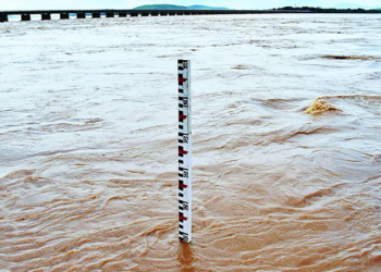
Meanwhile rivers like the Baitarani and Salandi have crossed danger levels, inundating low-lying areas, farmlands, and residential localities. Several districts, including Bhadrak, Jajpur, and others, have reported significant waterlogging, damaged roads, and disruption of normal life.
Schools, colleges, and Anganwadi centres have been closed in many affected districts as a precautionary measure.
The slow-moving nature of the system is likely to prolong the spell of rainfall, raising concerns over further worsening of the flood situation.