






Bhubaneswar: A fresh weather system is brewing over the Bay of Bengal, raising the possibility of a cyclone next week.
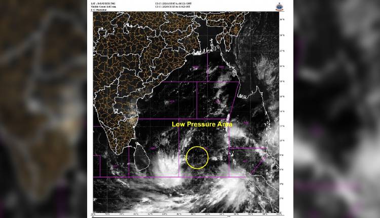
As per information shared by senior IMD scientist Uma Shankar Dash on his X handle, a low-pressure system is currently active in the southeastern Bay of Bengal. The system is likely to become a well-marked Low-Pressure on November 14, intensify into a Depression November 15, and by the evening of November 16, it is likely to form into a Cyclonic Storm in the central Bay of Bengal.
However, there are differing opinions among various weather models regarding its probable track and landfall. Therefore, the IMD has not yet clarified anything about the track and impact of the possible cyclone. A clear picture about its probable path and impact can only be obtained after it forms into a depression.
People have been advised to keep a close watch on official IMD bulletins over the next 48 hours as the system evolves.
According to the IMD, under the influence of yesterday’s upper-air cyclonic circulation over the central Andaman Sea and adjoining Andaman & Nicobar Islands, a low pressure area formed over the Southeast Bay of Bengal at 05:30 am and persisted over the same region at 08:30 am today. The associated cyclonic circulation extended up to 5.8 km above mean sea level.