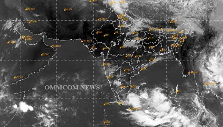
Bhubaneswar: The cyclonic circulation formed in the southeast Bay of Bengal is intensifying and, by its impact, a low-pressure area is likely to be formed in the area in the next few hours, a bulletin issued by the India Meteorological Department (IMD) on Monday read.
According to the IMD, the possible low pressure will intensify further and is likely to convert into a depression on Tuesday. Thereafter, the depression will concentrate into a cyclonic storm.
The cyclonic storm will then move in a northerly direction towards the central Bay of Bengal, stated the IMD.
The IMD has kept vigil on the system marked in the Bay of Bengal. Its density, movement, and direction will be cleared after the formation of low pressure.
Keeping in view the possible cyclone, fishermen have been asked not to venture into the sea, said the IMD.
“A cyclonic circulation lies over the southeast Bay of Bengal and neighbourhood in lower & middle tropospheric level. Under its influence, a low-pressure Area is likely to form over the same region by the 8th of May, morning. It is likely to concentrate into a depression over the Southeast Bay of Bengal around 9th May. Thereafter, it is likely to intensify into a cyclonic storm while moving nearly northwards towards the central Bay of Bengal,” the agency said in the bulletin.
Meanwhile, the maximum temperature (day temperature) has been soaring in Bhubaneswar and adjoining areas during the last couple of days.


