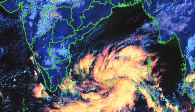
Bhubaneswar: The well-marked low-pressure area formed over the southeast Bay of Bengal on Thursday moved west-northwestwards during past 12 hours, concentrated into a depression and lay centered at 0530 hours IST on Friday over adjoining southwest Bay of Bengal near latitude 9.1°N and longitude 86.4°E, about 790 km east-southeast of Puducherry, 800 km southeast of Chennai, 990 km southeast of Bapatla and 970 km southeast of Machilipatnam, the India Meteorological Department (IMD) said this morning.
The depression is likely to move west-northwestwards, intensify into a deep depression by December 2, and further intensify into a cyclonic storm over the southwest Bay of Bengal around December 3. Thereafter, it would move northwestwards and cross south Andhra Pradesh and adjoining North Tamil Nadu coast between Chennai and Machilipatnam around the evening of December 4 as a cyclonic storm.
According to the weather office, the cyclonic storm is likely to have no impact on Odisha.
Meanwhile, light to moderate rain/thundershowers are forecast in the coastal areas of Odisha on Friday. Malkangiri, Koraput, Nabarangpur, Khandamal, Kalahandi, Rayagada, and a few places in Nuapada, Bolangir, and Boudh are also likely to experience rainfall today.


