


Bhubaneswar: A well-marked low pressure area formed over the west central and adjoining northwest Bay of Bengal and north Andhra Pradesh-south Odisha coasts is likely to move west-northwestwards and concentrate into a depression within the next 12 hours, informed the India Meteorological Department.
The system is expected to cross the south Odisha-north Andhra Pradesh coasts around forenoon on August 19, 2025.
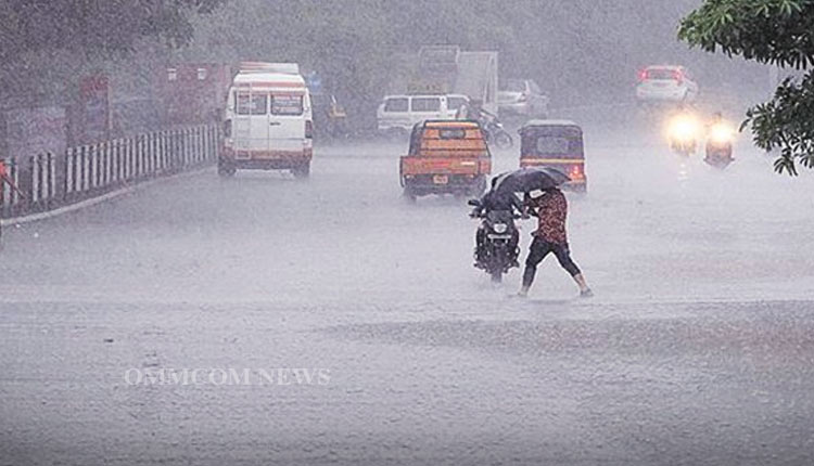
Under its influence, several Odisha districts are likely to experience very heavy to extremely heavy rainfall with thunderstorms and gusty winds.
Going by IMD prediction for August 19, Koraput, Malkangiri and Nabarangapur districts are likely to witness isolated heavy to very heavy rainfall with isolated extremely heavy falls and thunderstorms with lightning and gusty winds (30-40 kmph). The regional weather office has issued red warning to these districts.
Besides, an orange warning has been issued for the districts of Kalahandi, Rayagada, Gajapati, and Kandhamal, where heavy to very heavy rainfall and thunderstorms with lightning and gusty winds (30-40 kmph) are likely to occur.
A yellow warning has been issued for several other districts, including Ganjam, Nayagarh, Boudh, Balangir, Nuapada, Puri, Khurda, Cuttack, Balasore, Bhadrak, Jajpur, Kendrapara, Jagatsinghpur, Sundargarh, Jharsuguda, Bargarh, Sambalpur, Deogarh, Angul, Dhenkanal, Keonjhar, Mayurbhanj, and Sonepur where thunderstorm with lightning with gusty surface wind speed reaching 30-40 kmph are very likely to occur.
“Heavy rainfall and thunderstorm with lightning with gusty surface wind speed reaching 30-40 kmph are very likely to occur at one or two places over the districts of Nabarangapur, Nuapada, Kalahandi, Koraput, Malkangiri, Balangir and Rayagada”, reads the IMD prediction for August 20. These districts have been issued yellow warnings.
Additionally, thunderstorm with lightning with gusty surface wind speed reaching 30-40 kmph are very likely to occur at one or two places over the districts of Balasore, Bhadrak, Jajpur, Kendrapara, Cuttack, Jagatsinghpur, Puri, Khurda, Nayagarh, Ganjam, Gajapati, Sundargarh, Jharsuguda, Bargarh, Sambalpur, Deogarh, Angul, Dhenkanal, Keonjhar, Mayurbhanj, Sonepur, Boudh and Kandhamal on August 20. These districts are also under yellow alert,
According to weather prediction for August 21, thunderstorm with lightning with gusty surface wind speed reaching 30-40 kmph are very likely to occur at one or two places over the districts of Balasore, Bhadrak, Jajpur, Kendrapara, Cuttack, Jagatsinghpur, Puri, Khurda, Nayagarh, Ganjam and Gajapati.
“Thunderstorm with lightning with gusty surface wind speed reaching 30-40 kmph are very likely to occur at one or two places over the districts of Balasore, Bhadrak, Jajpur, Kendrapara, Cuttack, Jagatsinghpur, Puri, Khurda, Nayagarh, Ganjam and Gajapati”, read the IMD prediction meant for August 22. These districts have been issued yellow alerts.
“Heavy rainfall and thunderstorms with lightning with gusty surface wind speed reaching 30-40 kmph are very likely to occur at one or two places over the districts of Mayurbhanj, Keonjhar and Sundargarh, according to IMD prediction for August 23.


