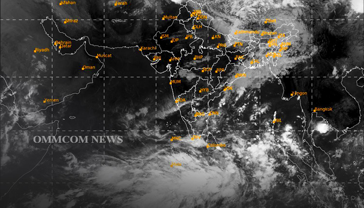
Bhubaneswar: The New Delhi-based Regional Specialised Meteorological Centre – Tropical Cyclones on Thursday issued a tropical weather outlook for the north Indian Ocean (the Bay of Bengal and the Arabian Sea) valid for the next 120 hours.
As per the tropical weather outlook, a cyclonic circulation is likely to develop over the southeast Bay of
Bengal around May 6 and a low-pressure area is likely to form under its influence over the region around May 7. It is likely to concentrate into a depression over southeast BoB on May 8. Thereafter, there is a good possibility of its intensification into a cyclonic storm while moving nearly northwards towards central BoB.
The system is under constant watch and being monitored regularly. The details of its path and intensification will be provided after the formation of a low-pressure area.
Scattered low and medium clouds with embedded intense to very intense convection lay over the southeast Bay of Bengal and the Andaman Sea. Scattered low and medium clouds with embedded moderate to intense convection lay over the central & southwest Bay of Bengal. Scattered low and medium clouds with embedded weak to moderate convection lay over the north Bay of Bengal, it said, and added, that the probability of cyclogenesis (formation of depression) during the next 96-120 hours is high.
According to the Regional Specialised Meteorological Centre – Tropical Cyclones, the sea conditions over BoB are also conducive for cyclogenesis. “Considering the model guidance, IMD GFS is indicating a low-pressure area (LPA) over southeast BoB around May 7, depression around May 8, and cyclonic storm (CS) around May 9.


