


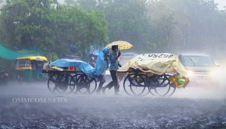
Bhubaneswar: A low-pressure system over the Bay of Bengal is likely to move northwest and intensify into a depression within the next 24 hours.
According to the India Meteorological Department (IMD), this system over the west-central and adjoining northwest Bay of Bengal and the adjoining seas along the north Andhra Pradesh and south Odisha coasts persisted and became more marked in the Sunday afternoon. It is likely to move west-northwestwards and intensify into a depression within the next 24 hours. The regional weather department has predicted that it will cross the south Odisha and north Andhra Pradesh coasts on the morning of August 19.
The IMD has issued a red alert for three districts in south Odisha, warning of heavy to very heavy rainfall in Koraput, Malkangiri, and Nabarangapur districts on Monday. Besides, scattered places in these areas are likely to experience extremely heavy rainfall. Additionally, Kalahandi, Rayagada, and Gajapati districts are also expected to receive heavy rainfall.
The weather department has forecast intense rainfall in several districts of Odisha, with Ganjam, Kandhamal, Boudh, Sonepur, Balangir, and Nuapada districts also likely to experience heavy rainfall. Thunderstorm and lightning accompanied by gusty winds are also possible in many areas of Odisha. Residents are advised to stay alert and take necessary precautions, as heavy rainfall may lead to waterlogging and disruptions in daily life.
According to the rainfall data, Paralakhemundi received the highest rainfall with 20 mm, followed by Jagatsinghpur with 14.2 mm and Bhubanipatna with 13.8 mm. Other areas that received notable rainfall include Talcher with 13.4 mm, Daringbadi with 12 mm, Nayagarh with 10 mm, Chandbali with 9.5 mm, and Balangir with 7.5 mm.


