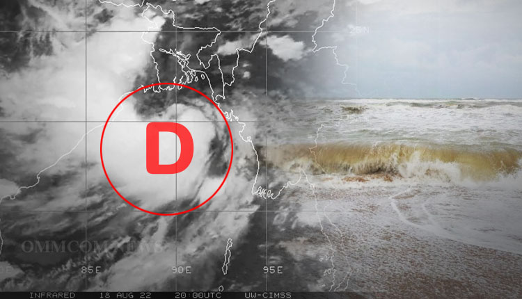
Bhubaneswar: Yesterday’s low pressure area over northeast and adjoining areas of Eastcentral Bay of Bengal, Bangladesh & Myanmar coasts moved northwestwards concentrated into a Depression and lay centered at 0530 Hrs IST of today over northwest & adjoining northeast Bay of Bengal about 310 km east-southeast of Balasore, 250 km east-southeast of Digha, and 210 km east-southeast of Sagar islands.
It is very likely to move west-northwestwards and intensify into a Deep Depression during the next 06 hours. Continuing to move in the same direction, it is likely to cross West Bengal and Odisha coast between Balasore & Sagar islands around 1730 Hrs IST of today. After landfall it would continue to move west-northwestwards across north Odisha, West Bengal, and Jharkhand towards north Chhattisgarh and weaken gradually.
Under its influence, heavy to very heavy rainfall (7 to 20 cm) at a few places with isolated extremely heavy falls (>20cm) is very likely to occur over the districts of Keonjhar, Bhadrak, Balasore, and Mayurbhanj today. Heavy to very heavy rainfall (7 to 20cm) is very likely to occur at a few places over the districts of Kendrapada, Jagatsinghpur, Cuttack, Dhenkanal, Angul, Deogarh, Sundargarh, Sambalpur, Sonepur, Boudh, Bolangir, and Jajpur.
Besides, heavy rainfall (7 to 11cm) is very likely to occur at isolated places over the districts of Jharsuguda, Bargarh, Kalahandi, Kandhamal, Ganjam, Nayagarh, Khordha, and Puri.
On August 20, heavy to very heavy rainfall (7 to 20cm) is very likely to occur at one or two places over the districts of Jharsuguda, Sundargarh,
Keonjhar, Deogarh, Sambalpur, Bargarh, Sonepur, and Bolangir. Heavy rainfall (7 to 11cm) is very likely to occur at isolated places over the districts of Mayurbhanj, Angul, Boudh, Kalahandi, Nuapada, Nawarangpur, and Dhenkanal.


