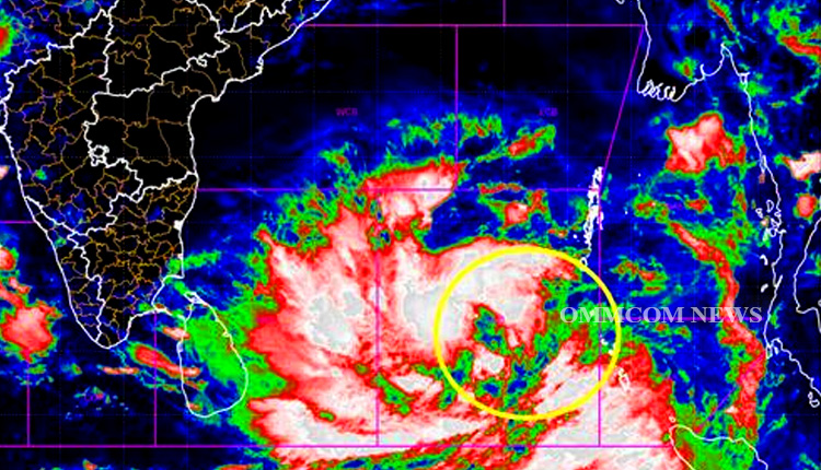
Bhubaneswar: The low-pressure area over Southeast Bay of Bengal and adjoining South Andaman Sea has become a well-marked low-pressure area over the same region at 5.30 am on Tuesday, the India Meteorological Department (IMD) said in a release today.
It is very likely to intensify into a depression by Tuesday evening over the same region and subsequently into a cyclonic storm over the southeast Bay of Bengal and adjoining areas of the east-central Bay of Bengal and the Andaman Sea on May 10. It is likely to move initially north-north-westwards till May 11. Thereafter, it is likely to recurve gradually and move north-north-eastwards towards the Bangladesh-Myanmar coasts.
Under the influence of the above system, there will be squally wind speed reaching 45-55 kmph gusting to 65 kmph prevails over the Southeast Bay of Bengal adjoining Andaman Sea and wind speed will gradually increase and become gale winds over Southeast and central Bay Bengal during May 10 to 13. Gale wind speed will be around 130-140 kmph gusting to 150 kmph over the east-central Bay of Bengal on May 12 and 13.
The sea condition will become high to very high on May 10 and 11 over the central and southeast Bay of Bengal and very high to phenomenal on May 12 and 13 over the east-central Bay.
Fishermen, small ships, boats, and trawlers are advised not to venture into the southeast and central Bay of Bengal and the Andaman Sea from May 9 onwards.


