


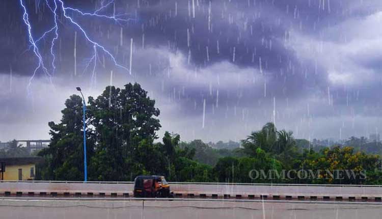
Bhubaneswar: The India Meteorological Department (IMD) on Tuesday issued orange and yellow warnings for thunderstorms with lightning, gusty surface winds reaching speeds of 50-60 km/h, hailstorms, and heavy rainfall. These weather conditions are very likely to occur during the afternoon or evening hours at one or two places across several districts of Odisha tomorrow (April 30).
According to the IMD’s midday weather bulletin, a trough in the westerlies—roughly along Longitude 84°E and north of Latitude 15°N—continues to persist. It is now seen between 5.8 km and 9.6 km above mean sea level. This system is expected to influence weather activity across the state.
In view of this, the IMD has issued an orange warning for Mayurbhanj, Balasore, Keonjhar, Bhadrak, Jajpur, and Kendrapara districts. These areas are likely to experience thunderstorms with lightning, gusty surface winds reaching 50-60 km/h, hailstorms, and heavy rainfall during the afternoon or evening hours on April 30.
Additionally, a yellow warning has been issued for Jagatsinghpur, Cuttack, Angul, and Dhenkanal, where thunderstorms with lightning, gusty winds of 40-50 km/h, and heavy rainfall are expected. Similar conditions—excluding heavy rainfall—are also likely to occur in the districts of Puri, Khurda, Nayagarh, Ganjam, Gajapati, Nuapada, Balangir, Kalahandi, Kandhamal, Nabarangpur, Rayagada, Koraput, Malkangiri, Jharsuguda, Sundargarh, Sambalpur, and Deogarh.
The IMD has further predicted that thunderstorm activity accompanied by lightning, gusty winds, hail, and heavy rainfall is expected to continue in various parts of Odisha until May 3.
Moreover, the IMD has predicted no significant change in maximum (daytime) temperatures across the state for the next four days. However, a rise of 2-4°C is likely in the following three days over most districts of Odisha.


