


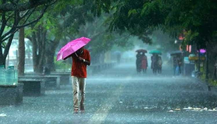
Bhubaneswar: A low-pressure area has developed over the Gangetic West Bengal and adjoining Bangladesh, which is likely to bring heavy rainfall to some parts of Odisha today, according to the prediction of the India Meteorological Department.
The low-pressure system will move northwestwards towards Jharkhand over the next 24 hours, likely bringing widespread rainfall to several districts in Odisha.
According to the IMD forecast, the state’s northern regions may experience significant rainfall, while the western parts, including Western Odisha, are already witnessing rising water levels in major rivers like Mahanadi, Brahmani, and Subarnarekha due to continuous rainfall.
The weather department has forecast heavy rainfall in Mayurbhanj, Keonjhar, and Sundargarh districts on Saturday. Other districts, including Balasore, Bhadrak, Jajpur, Kendrapara, Cuttack, Jagatsinghpur, Puri, Khordha, Nayagarh, Ganjam, Gajapati, Jharsuguda, Bargarh, Sambalpur, Deogarh, Angul, and Dhenkanal, may experience thunderstorms with rain.
According to reports, the current water level at the Hirakud reservoir stands at 620 feet, with an inflow of 2,43,831 cusecs per second. The dam authorities have issued a warning, advising people to avoid entering the Mahanadi River due to the rising water levels.
The water level in the Mahanadi River at Mundali has been rising, with a flow of 5.78 lakh cusecs of water recorded earlier. With the potential for further heavy rainfall, the situation remains under close watch.
Significant rainfall was recorded in various parts of the state on Friday, including Hirakud (42.2 mm), Rourkela (40 mm), Boudh (34 mm), Sambalpur (31.7 mm), Jharsuguda (31.6 mm), Bargarh (26.8 mm), Bhawanipatna (25.2 mm), Talcher (18.6 mm), Sonepur (15.2 mm), Angul (12 mm), Titlagarh (11.2 mm), and Daringbadi (10 mm).


