


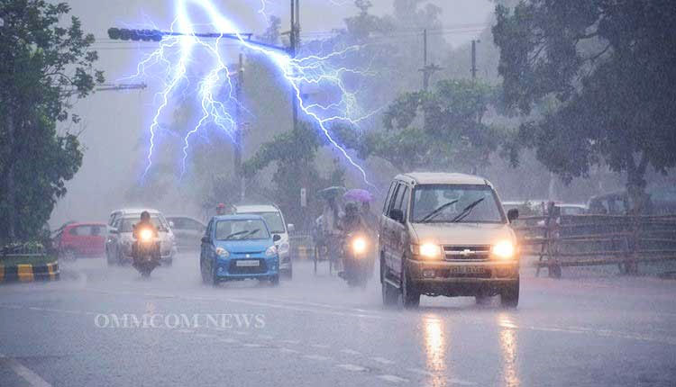
Bhubaneswar: The India Meteorological Department (IMD) on Saturday issued an orange warning for thunderstorms accompanied by lightning, hail and gusty winds in parts of Odisha, forecasting continued unstable weather conditions over the next few days.
According to the midday weather bulletin issued by the Meteorological Centre in Bhubaneswar, a trough extending from Gangetic West Bengal to south Tamil Nadu, along with an upper air cyclonic circulation over north Odisha, is influencing the prevailing weather across the state.
Light to moderate rainfall has already been recorded at several places, with squally winds reported in Bhubaneswar and Jharsuguda, reaching speeds of up to 56 kmph and 83 kmph respectively on Friday.
The IMD has issued an orange warning for Mayurbhanj, Keonjhar, Balasore and Bhadrak districts for Day 1 (valid till March 29 morning), where thunderstorms with lightning, hail and wind speeds of 50–60 kmph are likely at isolated places.
A yellow warning has been sounded for several other districts including Sundargarh, Angul, Dhenkanal, Jajpur, Kendrapara, Ganjam, Gajapati, Rayagada and Nayagarh, where wind speeds may reach 40–50 kmph. Coastal districts such as Cuttack, Puri and Khurda may experience winds of 30–40 kmph along with lightning activity.
The weather agency has forecast that thunderstorm activity will continue over the next three days, gradually affecting southern and coastal parts of the state, although intensity may vary with time.
IMD has warned that strong winds could cause damage to standing crops, banana plantations and weak structures, while loose objects may be blown away. People have been advised to remain indoors during thunderstorms, avoid taking shelter under trees, and stay away from water bodies and electrical conductors.
For fishermen, the IMD has issued a specific advisory not to venture into the sea along and off the north Odisha coast on March 28 due to rough to very rough sea conditions and squally winds reaching up to 60 kmph.
In Bhubaneswar and adjoining areas, partly cloudy skies with the possibility of rain or thunderstorms are expected over the next 24 hours, with temperatures likely to hover around 36°C (maximum) and 21°C (minimum).
The IMD said there will be no significant change in maximum temperatures over the next three days, followed by a gradual rise of 2–3°C thereafter.
Authorities have urged residents to monitor official updates and follow safety advisories amid the evolving weather situation.


