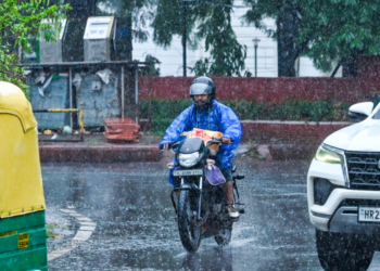







Bhubaneswar: The India Meteorological Department (IMD) on Tuesday issued an Orange warning for heavy to very heavy rainfall in five districts of Odisha over the next 24 hours, while forecasting widespread light to moderate rain and thunderstorms across the state for the next seven days amid active monsoon conditions.
According to the IMD’s midday weather bulletin, Sundargarh, Jharsuguda, Bargarh, Sambalpur and Nuapada are likely to experience heavy to very heavy rainfall till 8.30 am on July 22. A Yellow warning for heavy rainfall has also been issued for Balasore, Deogarh, Angul, Keonjhar, Mayurbhanj, Sonepur, Boudh, Bolangir, Kalahandi, Kandhamal and Nawrangpur during the same period. Thunderstorms accompanied by lightning and gusty surface winds reaching 30-40 kmph are likely at isolated places in 20 districts, including Cuttack, Jagatsinghpur, Kendrapara, Bhadrak, Balasore, Angul and Dhenkanal.
The weather office said light to moderate rain or thundershowers are likely to continue over all districts through July 28. Heavy rainfall warnings will persist over parts of northern and western Odisha between July 22 and July 27, while thunderstorm and lightning activity is expected to continue over several districts until at least July 26. No warning has been issued for July 27-28, although rainfall is likely to continue across the state.
The IMD attributed the prevailing weather to the monsoon trough extending from Sri Ganganagar to the northwest Bay of Bengal and another trough stretching from an upper air cyclonic circulation over the west-central Bay of Bengal across south Odisha to the northeast Arabian Sea.
During the 24 hours ending at 8.30 am on Tuesday, light to moderate rainfall occurred at most places across Odisha, while heavy rainfall was recorded at one or two places in Puri, Jharsuguda, Sundargarh, Bhadrak, Sambalpur, Mayurbhanj and Balasore districts. Kakatpur in Puri district recorded the highest rainfall of 11 cm, followed by Deogaon in Jharsuguda and Banaigarh in Sundargarh with 10 cm each.
The IMD warned that heavy rainfall could trigger localized flooding, waterlogging in low-lying urban areas, traffic disruptions, reduced visibility, minor damage to kutcha roads, vulnerable structures and standing crops, and possible landslides in susceptible areas. It advised people to avoid waterlogged locations, follow traffic advisories and refrain from staying in vulnerable structures.
For Bhubaneswar and its adjoining areas, the IMD has forecast a mainly cloudy sky with the possibility of rain or thunderstorms during the next 24 hours. The maximum and minimum temperatures are likely to hover around 32 degrees Celsius and 26 degrees Celsius, respectively.