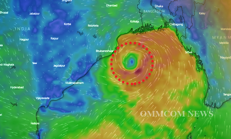
Bhubaneswar: The cyclonic circulation over South Andaman Sea and neighbourhood extending upto mid-tropospheric levels persists, as on Wednesday afternoon, the Indian Meteorological Department informed.
“Under its influence, a low pressure area is likely to form over the same region around May 6 (Friday). It is very likely to move northwestwards and intensify gradually into a Depression during subsequent 48 hours,” the afternoon bulletin issued by local station of IMD stated.
The system is likely to move towards the Indian coastline and intensify into a depression by May 8 (Sunday). If this depression turns into a cyclone, its name will be Asani, (given) by Sri Lanka.
During the next five days, Odisha is expected to witness Nor’wester rains and thundershowers. IMD DG Mrutyunjay Mohapatra said the conditions seem favourable for the formation of a cyclone over the Bay of Bengal. Intensity and place of landfall will be possible to forecast only after a low pressure area is formed, he added.
Meanwhile, the IMD has predicted thunderstorm accompanied with lightning and squall surface wind speed reaching 50-60 kmph likely at one or two places over Bhadrak, Cuttack, Jagatsinghpur, Kendrapara Jajpur, Khurda, and Puri, during the next 24 hours.
Thunderstorm with gusty surface wind reaching 40-50 kmph very likely to occur at one or two places over the districts of Keonjhar, Mayurbhanj, Balasore, Dhenkanal, Nawarangpur, Koraput, and Malkangiri.
“Thunderstorm with lightning is very likely to occur at one or two places over Balasore, Bhadrak, Jajpur, Kendrapara, Cuttack, Jagatsinghpur, Gajapati, Ganjam, Khurda,Puri, Nayagarh, Kalahandi, Kandhamal, Sundargarh, Deogarh, Boudh, and Rayagada.”


