






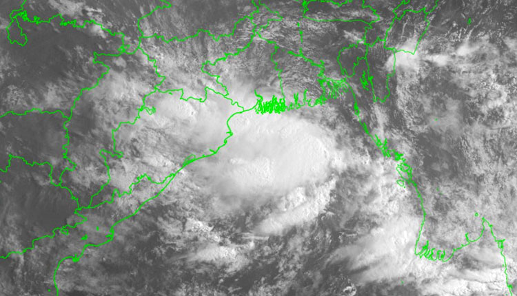
Bhubaneswar: Under the influence of a cyclonic circulation over South West Bengal and adjoining Bangladesh, a low pressure area has formed over the Northwest Bay of Bengal and adjoining Gangetic West Bengal-North Odisha coasts, according to the India Meteorological Department.
The system is likely to become more marked during the next two days, informed the IMD.
Taking to his X handle, weather scientist Uma Shankar Das wrote: “According to the observation at 5:30 am today, due to the active cyclonic circulation, a low pressure area has formed over the North-West Bay of Bengal adjacent to the West Bengal-Odisha coast. There is a possibility of it becoming more intense within the next two days.”
The IMD has issued an orange warning for very heavy rainfall today in four districts including Keonjhar, Angul, Dhenkanal, and Cuttack. Additionally, a yellow warning for heavy rainfall has been issued for 16 districts. These include: Puri, Khordha, Nayagarh, Jagatsinghpur, Kendrapara, Jajpur, Bhadrak, Balasore, Mayurbhanj, Sundargarh, Jharsuguda, Deogarh, Sambalpur, Bargarh, Sonepur, and Boudh.The weather department has also forecast gusty winds with speeds of 30 to 40 kmph accompanied by rain over these districts.
Due to expected rough sea conditions, fishermen have also been strictly advised not to venture into the sea till July 27.
The IMD has urged people in the affected districts to stay alert, avoid waterlogging-prone areas, and take necessary precautions against lightning and strong winds. Farmers and residents in low-lying areas have also been asked to remain cautious of water accumulation.