






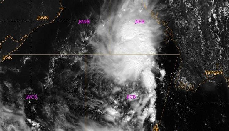
Bhubaneswar: The Well Marked Low Pressure Area over East-central and adjoining Southeast Bay of Bengal persisted over the same region at 8:30 AM today, the IMD said.
The associated cyclonic circulation extends up to 5.8 km above mean sea level. It is most likely to persist over the same region and intensify into a Depression today, thereafter move west-northwestwards and intensify further into a Deep Depression on October 25 and into a Cyclonic Storm over the West-central Bay of Bengal by October 26 morning.
Moving west-northwestwards, it would continue to intensify further and reach over West-central Bay of Bengal near Andhra Pradesh coast around morning of October 28.Dry weather is likely to prevail over Odisha for the next three days.
October 27: Orange Warning for Jagatsinghpur, Rayagada, Koraput, Malkangiri, Gajapati, Ganjam and Puri where heavy to very heavy rainfall is very likely at one or two places. Thunderstorm with lightning and gusty surface wind reaching 40-50 kmph is also very likely in Rayagada, Koraput, Malkangiri, Gajapati, Ganjam and Puri.Yellow Warning for Balasore, Bhadrak, Jajpur, Kendrapara, Cuttack, Keonjhar, Mayurbhanj, Kandhamal, Nabarangpur, Khordha and Nayagarh for heavy rainfall and thunderstorm with gusty wind 30-40 kmph gusting to 50 kmph.
Red Warning on October 28: Red Warning for Rayagada, Koraput, Malkangiri, Gajapati and Ganjam where heavy to very heavy rainfall at a few places with extremely heavy rainfall at one or two places is very likely. Thunderstorm with lightning and gusty wind 60-70 kmph gusting to 80 kmph is also likely.
Orange Warning for Balasore, Bhadrak, Jajpur, Kendrapara, Jagatsinghpur, Cuttack, Mayurbhanj, Subarnapur, Boudh, Nuapada, Balangir, Kalahandi, Kandhamal, Nabarangpur, Puri, Khordha and Nayagarh for heavy to very heavy rainfall and thunderstorm with gusty wind 40-50 kmph gusting to 60 kmph.
Yellow Warning for Sundargarh, Jharsuguda, Sambalpur, Bargarh, Deogarh, Angul, Dhenkanal and Keonjhar for heavy rainfall and thunderstorm with wind 30-40 kmph gusting to 50 kmph.