Bhubaneswar: As per forecast of IMD, Bhubaneswar, the Low Pressure Area over central parts of North Bay of Bengal now lies over Northwest & adjoining Westcentral Bay of Bengal and the associated cyclonic circulation extends upto 7.6 km above mean sea level tilting southwestwards with height.
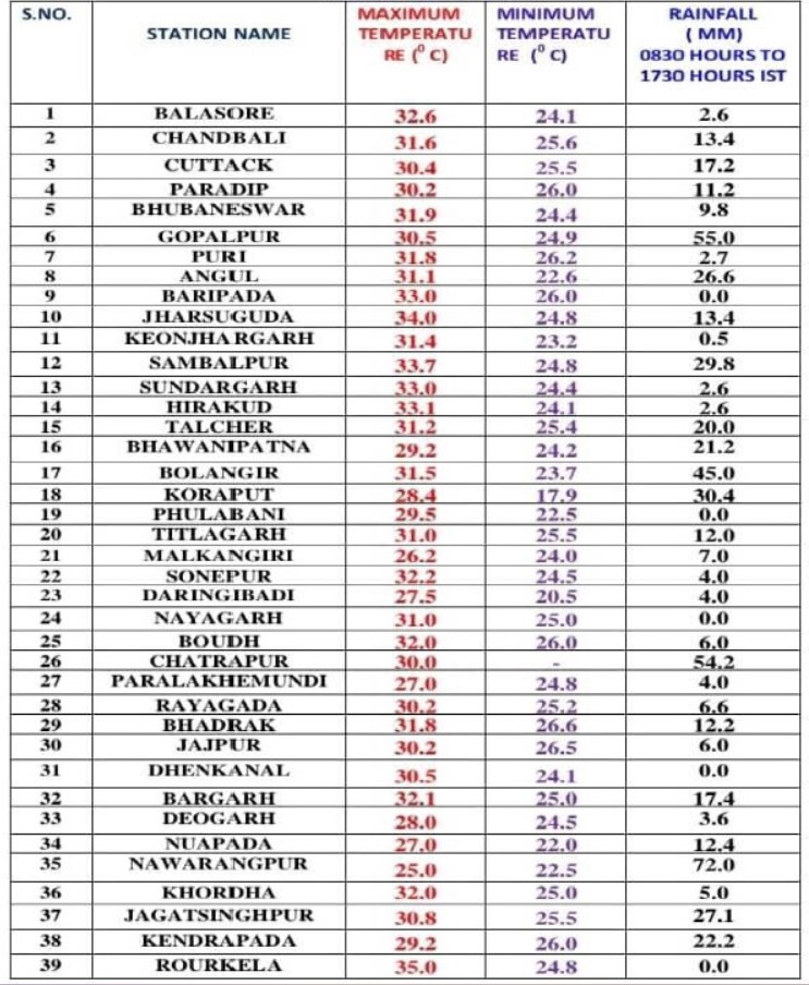
It is likely to become more marked during next 24 hours and move across south Odisha and south Chhattisgarh during next 3 days, the IMD forecast informed. Under the impact of the system, several parts of the State recorded moderate to heavy rainfall. The rainfall recorded at various places till 5.30 PM is as under:


