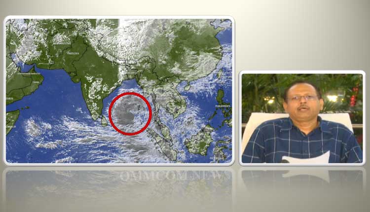
Bhubaneswar: The marked low pressure area over southeast Bay of Bengal and adjoining Andaman Sea has moved northwestwards and concentrated into a depression, informed Special Relief Commissioner (SRC) PK Jena.
“As per the IMD, it is currently located 150 km west of Car Nicobar and about 1250 km south-southwest of Puri and is moving in the northeastwards direction. Till May 10 it will move in the northeastwards direction towards north Andhra Pradesh and south coast of Odisha and around midday, it will recurve in the north northeastwards direction (which means it will take a right turn). At the time of recurve, it will be at a sufficient distance of about 150-200 km from the coast. After recurve it will move parallel along the Odisha coast and move in the direction of north Bay of Bengal,” Jena elaborated.
A combined analysis of track estimation by IMD and Joint Typhoon Warning Centre of the US Navy till now shows that it won’t touch Odisha coast at any place, he added.
The SRC said that under its influence there will be rains and wind at some places. He, however, added that by tomorrow the picture will be clear at what distance the possible cyclone will be moving away from Odisha coast.
“If the distance is more then, its impact will be less and if it’s closer the impact will be little more. As per the estimation till now, wind speed is likely to reach 50-60 KMPH in the coastal districts. Under its impact rain is likely in the districts of Ganjam, Gajapati, and Puri on May 10. In some places heavy rainfall is likely to occur, 70-110 mm rain is expected to occur in the districts of Ganjam, Puri, Jagatsinghpur, Khordha, and Cuttack,” he said.
The sea will remain rough so the state government has issued orders prohibiting fishermen from going into the sea from May 8 and efforts are underway to get back those in the sea by the morning of May 8, the SRC said.


