






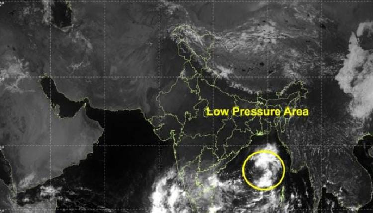
Bhubaneswar: The India Meteorological Department’s Meteorological Centre in Bhubaneswar has issued a red warning for multiple districts in Odisha as a cyclonic storm continues to intensify over the Bay of Bengal.
The cyclonic storm, brewing over the Bay of Bengal, is likely to approach the coast of north Andhra Pradesh and south Odisha on the morning of October 28, raising serious concerns of extremely heavy rainfall and associated hazards in the region.
According to the special weather bulletin issued by the IMD, a red warning has been sounded for Puri, Ganjam and Gajapati districts for the period from 08:30 am of October 27 to 08:30 am of October 28. During this phase, heavy to very heavy rainfall is expected at a few places, with extremely heavy rainfall exceeding 20 cm likely at one or two locations.
The threat intensifies further the following day. From 08:30 am of October 28 to 08:30 am of October 29, the red warning has been extended to Ganjam, Gajapati, Rayagada, Koraput and Malkangiri districts. These areas are likely to experience heavy to very heavy rainfall at a few places, accompanied by isolated extremely heavy downpours.
In addition to the red alerts, orange warnings have been issued for a wide stretch of coastal and adjoining districts, while yellow warnings cover several inland areas.
Authorities have urged residents in the red-warning zones to take immediate precautionary measures, remain indoors during intense spells, and stay updated through official channels as the cyclonic system edges closer to the coast.
As per IMD prediction, the low pressure is likely to turn into a depression tomorrow and intensify into a deep depression by October 25.By October 26, it may intensify into a cyclonic storm over the central Bay of Bengal. It will further intensify and move towards the coast. There is a possibility of it hitting the north Andhra-south Odisha coast on the morning of October 28.