





Kathmandu: Nepal lost or disabled several critical hydrological monitoring stations during the devastating August 26 Bhote Koshi-Trishuli flood, undermining the availability of real-time river data as the extreme flood wave moved rapidly downstream, according to a government assessment.
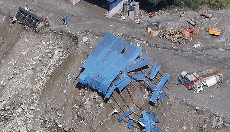
The Assessment Report II, prepared by the Centre of Hydrology and Water Resources Research (CHWRR) under the Water and Energy Commission Secretariat of the Government of Nepal, said the flood was severe enough to destroy or disable several key hydrological monitoring stations along the Bhote Koshi-Trishuli river corridor.
The affected stations included those at Rasuwagadhi, Syaphru Besi, Betrawati and Phurke Khola in Malekhu, all located along the Bhote Koshi and downstream Trishuli river corridors, which were badly affected by the devastating floods, the report said.
At Rasuwagadhi (Timure), data transmission ceased at 8:40 a.m., with the final recorded water level at 3.8 metres, after which the station was washed away by the flood in the Bhote Koshi River.
At Syaphru Besi, transmission stopped at 8:50 a.m., when the last recorded water level was 1.62 metres, and the station was subsequently swept away by the deadly flood in the Bhote Koshi, a transboundary river between Nepal and China.
The Betrawati station on the Trishuli River also stopped transmitting at 9:20 a.m., after recording a water level of 3.55 metres, and was washed away by the flood.
The Phurke Khola station at Malekhu in Dhading district was destroyed after the water level exceeded the danger threshold at 11:43 a.m. The flood also washed away the associated bridge, according to the assessment.
The report said the loss of these stations “highlights the extreme nature of the flood event” and poses challenges for future monitoring in the affected region.
Sauharda Joshi, a hydrologist at the Department of Hydrology and Meteorology, told IANS that the hydrological stations were unable to capture the exact flood levels because the massive flood washed them away on August 26.
“It is because of the massive flood that flowed at too high a velocity,” Joshi, who is one of the officials involved in preparing the report, said.
According to the report, the destruction of the monitoring network was particularly significant because the flood developed with exceptionally rapid propagation and a very short warning lead time.
The assessment estimated that the flood wave travelled about 22 km from its source area to the Rasuwagadhi border in approximately seven minutes, at an average speed of about 188 km per hour.
Following the loss of the hydrological stations at these sites, Nepal has installed a CCTV camera at Timure, Rasuwagadhi, to visually monitor river conditions. Likewise, the process of installing flood-monitoring systems in the Betrawati and Phurke Khola areas has been initiated.
“The locations for installing the flood-monitoring systems have been identified at these two locations following field visits,” said Joshi.
However, there are currently not enough flood-monitoring systems in place following the latest disaster, he said.
“That’s why the immediate risk is that we are without a flood-warning system in the Bhote Koshi and Trishuli,” he said.
According to Joshi, discussions are currently underway on whether to install two separate monitoring systems — one along the riverbank and another at a higher location — so that damage to a monitoring system located along the riverbank would not completely disrupt monitoring, as the second station could continue to provide flood data.
(IANS)