


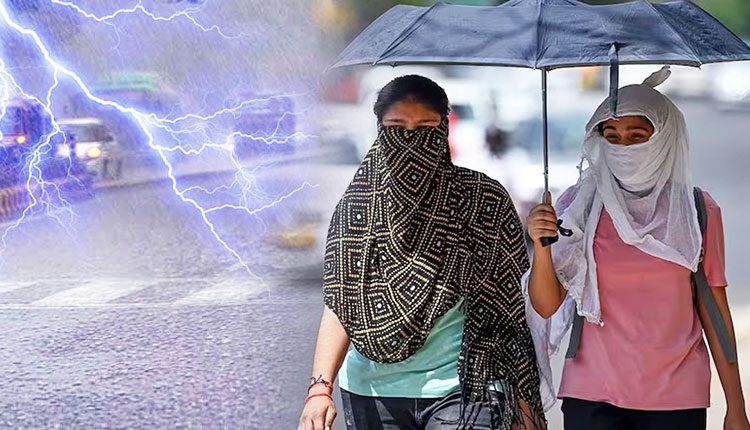
Bhubaneswar: The India Meteorological Department on Tuesday painted a mixed weather picture for Odisha over the coming week, warning of intensifying heat and humidity across large parts of the state even as isolated thunderstorms are expected to make a return from April 17 onwards.
In its midday bulletin, the Meteorological Centre Bhubaneswar said a north-south trough extending from south Assam to south Tamil Nadu, coupled with an upper air cyclonic circulation over Jharkhand and adjoining Gangetic West Bengal, continues to influence weather conditions over Odisha.
The impact of these systems was visible in the past 24 hours, with light to moderate rainfall reported at isolated places in southern districts such as Ganjam and Kandhamal, while the rest of the state remained largely dry. Chikiti recorded 4 cm of rainfall and Daringibadi 1 cm. Shallow fog was also observed in parts of Keonjhar district.
Temperature variations remained modest, with a slight drop of 2–3°C in some coastal pockets and a marginal rise of around 2°C in interior regions. Titilagarh emerged as the hottest place in the state at 41.0°C, while Rourkela recorded the lowest minimum temperature at 21.1°C.
The weather office has, however, cautioned that dry conditions will dominate across Odisha for the next couple of days, accompanied by a spell of hot and humid weather, particularly in coastal and adjoining districts. A Yellow Warning has been issued for districts including Balasore, Bhadrak, Jajpur, Kendrapara, Cuttack, Jagatsinghpur, Puri, Khurda, Nayagarh, Ganjam and Gajapati, where discomfort due to humidity is likely to persist.
From April 16, the focus is expected to shift to western Odisha, where heat wave conditions may develop at isolated places in districts such as Bolangir, Jharsuguda, Sambalpur and Sonepur. The intensity and spread of the heat are likely to increase in the following days, extending to more districts including Angul, Boudh, Kandhamal and Sundergarh.
Even as the heat builds up, the IMD has indicated a change in weather from April 17, when light to moderate rainfall and thunderstorms are likely to occur at isolated places. Northern districts such as Mayurbhanj, Keonjhar and Balasore may witness thunderstorm activity accompanied by lightning and gusty winds reaching speeds of 30–40 kmph.
Subsequently, the thunderstorm belt is expected to shift towards southern Odisha between April 18 and April 20, affecting districts like Ganjam, Gajapati, Rayagada, Koraput and Malkangiri. Similar activity may persist in isolated pockets till April 21.
Meanwhile, the IMD has forecast a gradual rise in maximum temperatures by 2–4°C over the next three days, signalling a steady intensification of summer conditions across the state, with no significant relief thereafter.
In Bhubaneswar and its neighbourhood, the weather is expected to remain partly cloudy over the next 24 hours, with temperatures likely to hover around 37°C and 27°C. Morning observations showed a maximum temperature of 35.3°C, minimum of 26.9°C, and high humidity levels.
The farmers’ bulletin indicated dry weather over the next 24 hours but advised caution due to hot and humid conditions in several districts. No adverse weather warning has been issued for fishermen along the Odisha coast for the next five days.
Residents have been advised to take precautions against heat exposure and remain alert for sudden thunderstorm activity later in the week.


