






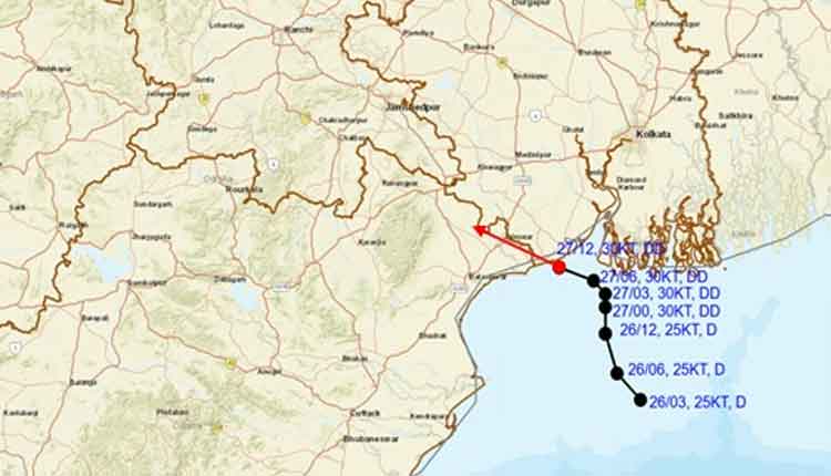
Bhubaneswar: A deep depression over the northwest Bay of Bengal moved slowly towards the west-northwest on Monday evening and is expected to cross the West Bengal-North Odisha coast by early Tuesday morning, according to the India Meteorological Department (IMD).
In its National Bulletin No. 8 issued at 9.15 pm, the IMD said the weather system had moved at a speed of around 7 kmph during the previous six hours. At 5.30 pm, it was centred over the northwest Bay of Bengal, close to the West Bengal coast, near latitude 21.6°N and longitude 87.7°E.
The system was located about 20 km east of Digha and 20 km south-southwest of Contai in West Bengal. It was also positioned around 40 km west of Sagar Island, 60 km southwest of Haldia, 80 km east of Balasore in Odisha, and 120 km southwest of Canning in West Bengal.
The IMD said the deep depression is very likely to continue moving nearly west-northwestwards and is expected to cross the West Bengal-North Odisha coast between east of Digha and west of Haldia by the early morning of July 28.
The weather office is closely monitoring the system, which is expected to influence weather conditions over coastal districts of Odisha and West Bengal as it approaches landfall.