


Bhubaneswar: The India Meteorological Department (IMD) has forecast enhanced rainfall activity across Odisha over the coming days with the formation of two cyclonic circulations.
According to IMD, a cyclonic circulation is likely to develop over the South Odisha–North Andhra Pradesh coast between June 25 and 26, which may trigger rainfall, including heavy spells, in southern districts from June 25 to 27. Subsequently, another low-pressure area is expected to form between July 2 and 4, further intensifying monsoon activity across the state.
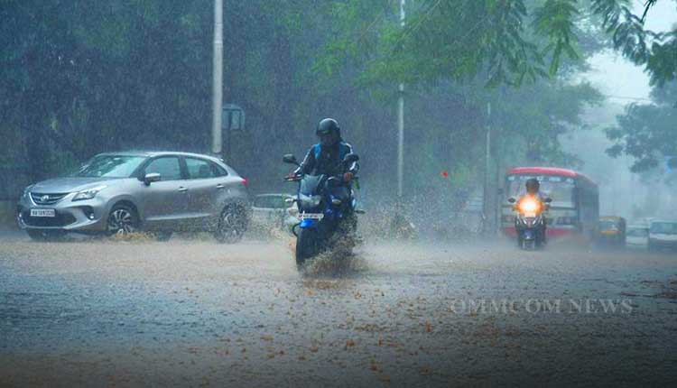
Due to active cloud cover over the Bay of Bengal and the influence of the southwest monsoon, rain and thundershowers are already occurring in many parts of the state.
Meanwhile for Monday, the IMD has predicted heavy rainfall with thunderstorm and lightning at one or two places over Rayagada, Koraput, and Malkangiri districts. Gusty winds reaching 50 to 60 kmph are also likely during thunderstorms. Thunderstorms accompanied by rain are also expected over several other districts including Balasore, Bhadrak, Jajpur, Kendrapara, Jagatsinghpur, Cuttack, Angul, Dhenkanal, Keonjhar, Mayurbhanj, Sonepur, Boudh, Nuapada, Balangir, Kalahandi, Kandhamal, Nabarangapur, Gajapati, Ganjam, Puri, Khordha, and Nayagarh.
On Sunday, Sonepur received the highest rainfall of 49.2 mm. Other districts recorded light to moderate rain, with Nayagarh receiving 5 mm, Malkangiri 3.2 mm, Sambalpur 2.4 mm, and Bargarh 2.2 mm. Day temperatures remained below 40°C in most parts of the state. Sambalpur recorded 39.8°C, Hirakud 39.3°C, Sundargarh 38.5°C, Balangir 38.2°C, Dhenkanal 37.6°C, and Nuapada 37°C. However, the coolest place was Daringbadi with a maximum temperature of just 28.5°C.
The IMD has advised people to remain alert, especially in southern Odisha, as thundershowers accompanied by strong winds may occur in the coming days.


