


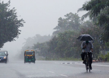
Bhubaneswar: The India Meteorological Department (IMD) has forecast thunderstorm activity over several parts of Odisha during the afternoon and evening hours in the next 24 hours.
According to the latest weather bulletin, an upper air cyclonic circulation lies over the Gulf of Mannar and adjoining Sri Lanka. Under its influence, a low-pressure area is likely to form over the Southwest Bay of Bengal around May 11.
Meanwhile, the IMD has issued an Orange Warning for Mayurbhanj, Keonjhar, Sundargarh, Balasore, and Bhadrak districts. Thunderstorms accompanied by lightning, hail, and strong gusty winds reaching 50 to 60 kmph are very likely to occur at one or two places in these districts.
A yellow warning has been issued for the remaining districts including Jajpur, Kendrapara, Cuttack, Jagatsinghpur, Puri, Khurda, Nayagarh, Ganjam, Gajapati, Jharsuguda, Bargarh, Sambalpur, Deogarh, Angul, Dhenkanal, Sonepur, Boudh, Nuapada, Balangir, Kalahandi, Kandhamal, Nabarangapur, Rayagada, Koraput, and Malkangiri. Thunderstorms with lightning and gusty winds (40-50 kmph) are expected at one or two places in these areas.
The IMD has advised people to remain alert and take necessary precautions against lightning, hailstorms, and strong winds. Farmers and those working outdoors have been asked to avoid open areas during the afternoon and evening.


